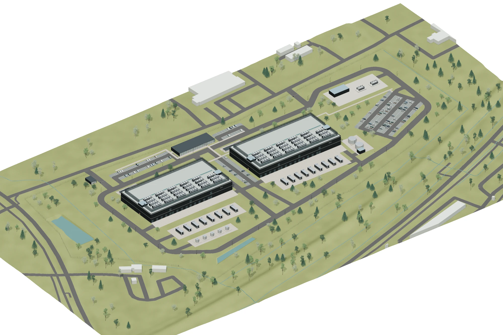
Kouvola, Finland · Site and campus study
The expensive choice appears before the first building is designed.
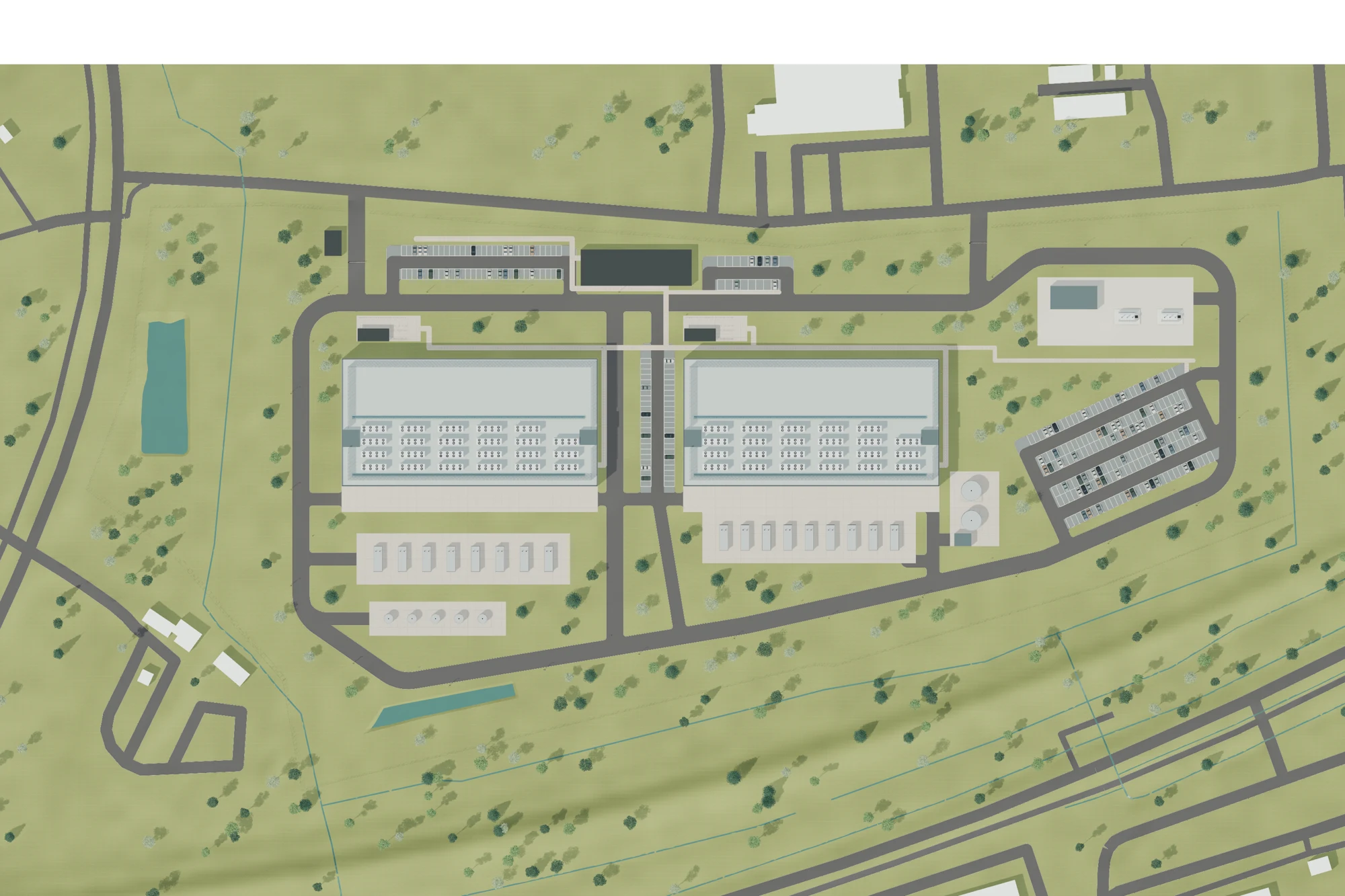
On a real 11.14-hectare parcel, Earendil compared three layouts for the same proposed data center programme. Each was tested against 34.2 MW of IT load. Under the study's parking allowance, the two-building option keeps all 304 spaces at ground level. The two four-building options place 288 of those spaces in a parking structure.
The building count changes what must be built on the land. It is a consequence worth seeing before committing to the next design stage.
Kouvola is Earendil's public reference case. The 45 MW incoming electrical programme is a design scenario; grid capacity and development approvals remain to be established.
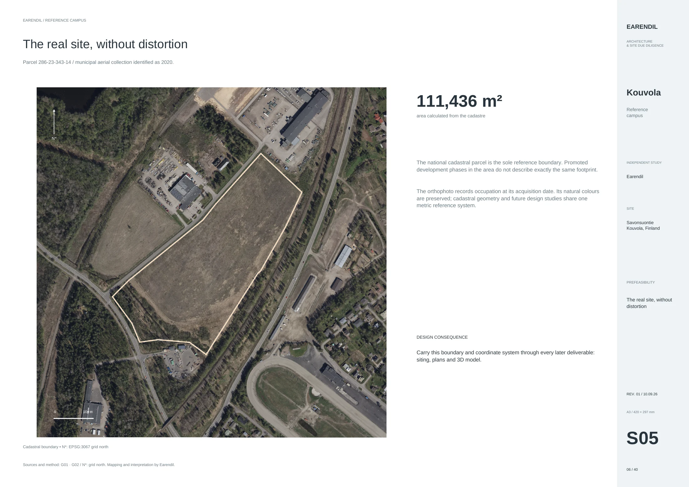
The land has to carry the entire campus.
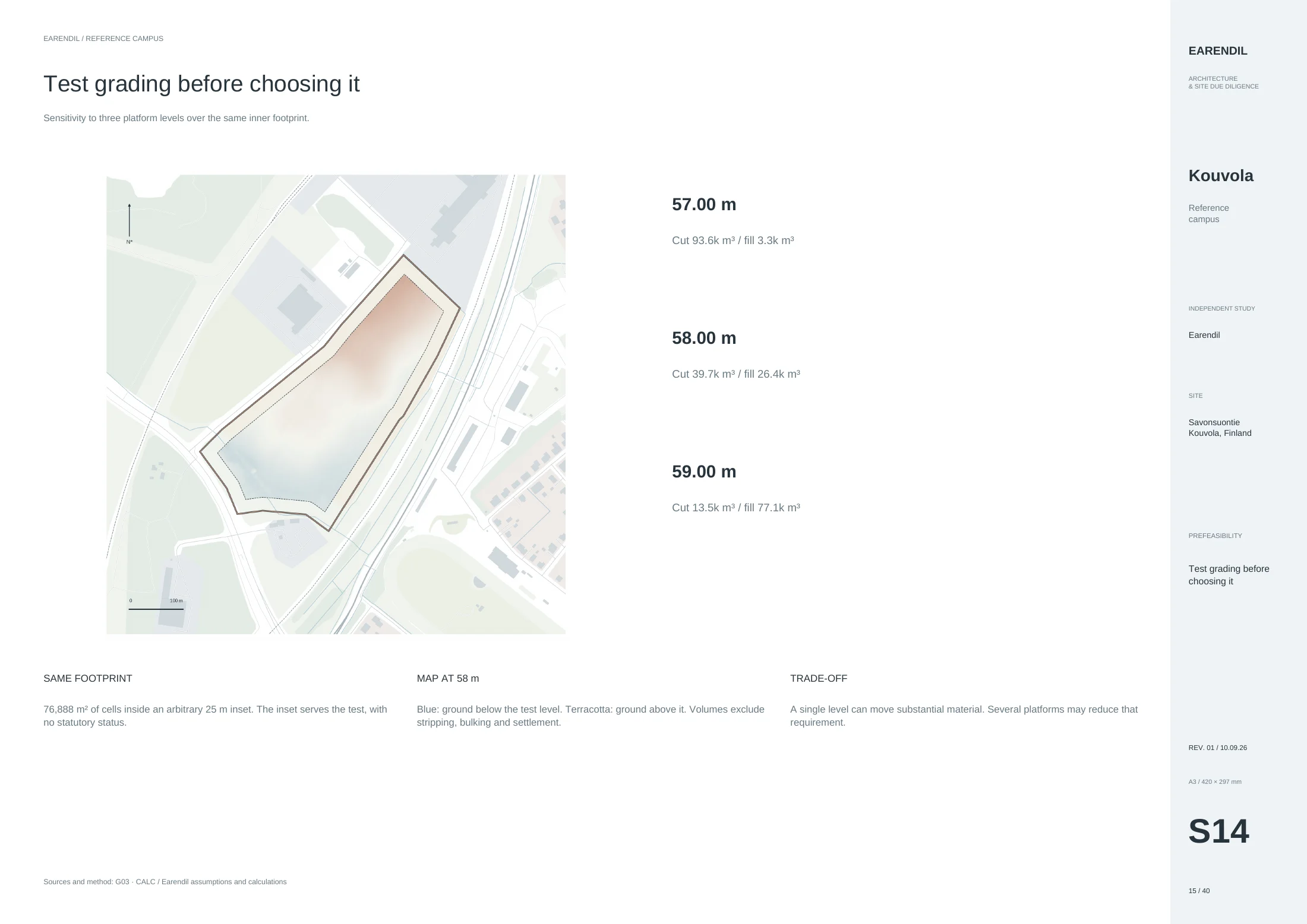
The cadastral area is only the starting point. The site study maps 6.03 metres of ground relief and tests three platform levels over the same footprint. At 57 metres, its indicative calculation gives 93,600 m³ of cut and 3,300 m³ of fill. At 59 metres, it gives 13,500 m³ of cut and 77,100 m³ of fill. These screening calculations exclude stripping, bulking and settlement. They show why building levels should be tested before they are fixed.
Water and ground conditions also claim space. A municipal planning report describes a large ditch carrying runoff from upstream areas. A regional geological map places much of the studied parcel in a clay class; its scale calls for a ground investigation before foundations are designed. The study reserves land for drainage rather than drawing buildings across it.
Power nearby is a question, not an allocation.
A mapped 110 kV enclosure lies close to the parcel, but proximity establishes neither available capacity nor a connection route. The electrical analysis turns the proposed 45 MW incoming programme into 34.2 MW of studied IT load using an explicit 5% reserve and a peak design factor of 1.25. Those assumptions make the layouts comparable.
Same programme.
Different land consequences.
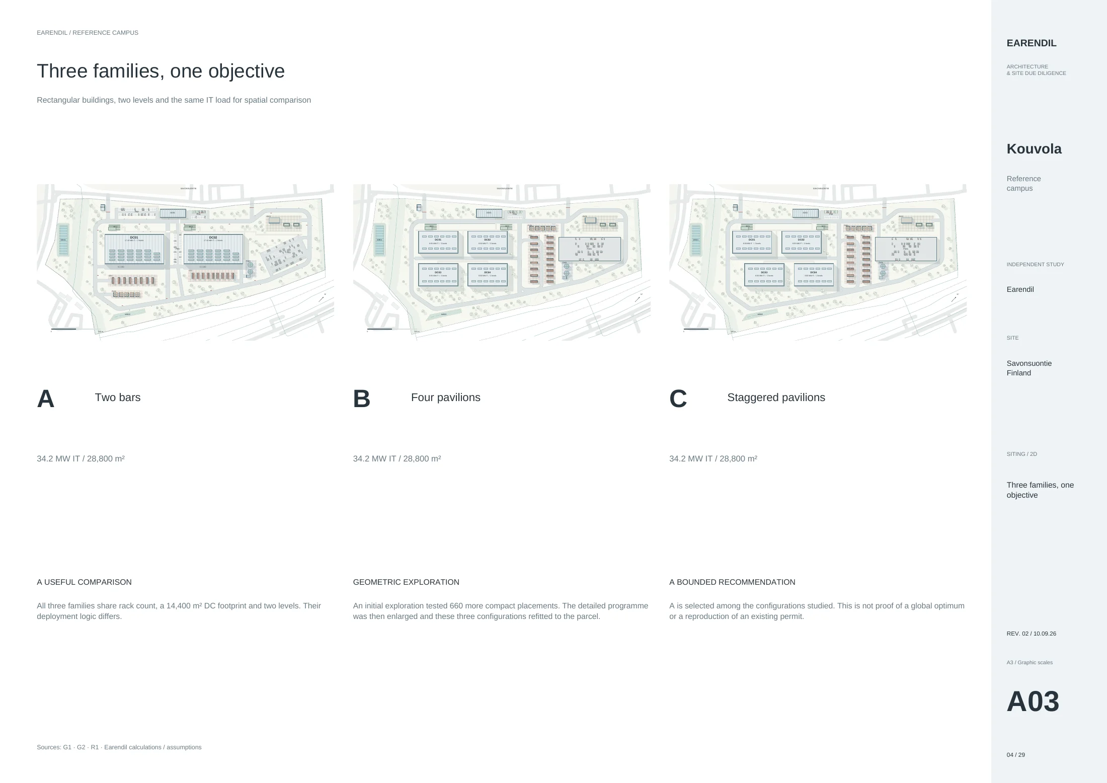
The first study examines 30, 45 and 60 MW electrical programmes and takes 45 MW forward as the central case to test. The siting study compares three configurations at the same IT load and data center floor area: two buildings of 120 × 60 metres, four aligned pavilions of 80 × 45 metres, and four staggered pavilions of the same size.
| A · Selected | B · Aligned | C · Staggered | |
|---|---|---|---|
| Buildings | 2 × 120 × 60 m | 4 × 80 × 45 m | 4 × 80 × 45 m |
| IT load | 34.2 MW | 34.2 MW | 34.2 MW |
| Car parking | 304 at ground level | 304 total; 288 in structure | 304 total; 288 in structure |
| Minimum building separation | 40 m | 20 m | 20 m |
Comparison from Siting & Architecture, p. 10 ↗. B and C are envelope comparisons; their internal plans were not developed to the same level as A.
The study selects the two-building scheme for the next design stage. It reduces fragmentation and keeps the parking programme at ground level. Four pavilions could still suit an operator that needs four independent building units.
For a landowner or developer, the useful outcome is a preferred configuration, the reasons for choosing it, and the facts that could change the decision. Kouvola makes those reasons inspectable across a 40-page site study, a 29-page siting study and a 36-page 3D masterplan. The same parcel boundary carries through terrain analysis, alternatives, equipment areas, circulation, plans and sections.
Spend next on the facts that could change the answer.
The next work is clear: qualify land rights and planning rules; seek an actual power offer; survey utilities, ground and drainage; and test access, noise and fire requirements. Option A provides a basis for that work.
Assessing a parcel in the United States or Switzerland? Send its boundary and target load to Earendil. We can discuss which layouts to test and which unresolved facts could change your next commitment.
Discuss a parcel Explore the full Kouvola studies and interactive model